Category:Maps of the United States
Help
Wikimedia Commons has media related to Maps of the United States.
| This page is part of Wikipedia's repository of public domain and freely usable images, such as photographs, videos, maps, diagrams, drawings, screenshots, and equations. Please do not list images which are only usable under the doctrine of fair use, images whose license restricts copying or distribution to non-commercial use only, or otherwise non-free images here. Please also consider uploading new free images and transferring images in this category to the Wikimedia Commons so that they may be more widely used. |
Subcategories
This category has the following 2 subcategories, out of 2 total.
Τ
- United States map templates (5 C, 217 P)
Pages in category "Maps of the United States"
The following 13 pages are in this category, out of 13 total. This list may not reflect recent changes.
Media in category "Maps of the United States"
The following 4 files are in this category, out of 4 total.
-
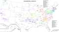 Cbdii.PNG 2,555 × 1,375; 362 KB
-
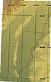 Crowleys Ridge relief.jpg 378 × 615; 26 KB
-
 KXNA route map.gif 720 × 360; 21 KB
-
 WOODFORDMAP.jpg 2,575 × 1,812; 1.41 MB


